Touring Gold Country and the Coast Mountains
“Collecting Nuggets” | Spring/Summer/Fall | Week-Long Roadtrip
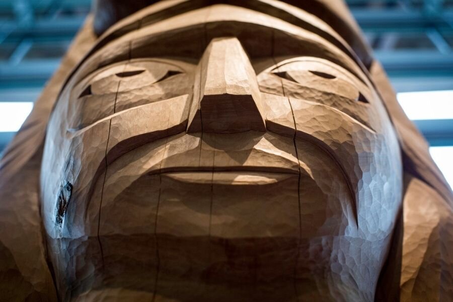
Squamish Lil'wat Cultural Centre/Blake Jorgensen
“hénłeʔ” Welcome to the unceded territory of the Nlaka’pamux (/ɪŋkləˈkæpmə/ ing-klə-KAP-mə) Interior Salish People.
Land of golden sunrises, fiery sunsets, and the dancing glow of Northern Lights – this route takes you from Cache Creek to Lillooet and Mile Zero, the start of the Gold Rush Trail, on its way west to Whistler. Travelling through the Cariboo on Indigenous trade paths is a journey steeped in history and boundless beauty.
A traveller is one who “immerses themself in the places they visit.” Responsible travellers plan, choosing experiences that leave a small ecological footprint. Our road trips are packed full of culture, and we encourage you to stop in rural or Indigenous communities, stay in locally run accommodations, eat and sip at small shops, and buy from local artisans.
Our trips are all connected, but you can experience them independently or combine to create the adventure of a lifetime!
The Vagabonds.
Cache Creek
Early morning stop, stay for lunch.
The first leg of our road trip begins in Blue Sky Country (Thompson-Nicola). Home to arid landscapes where tumbleweeds blow and sagebrush thrives, you can find native cactus growing in the rolling hills and surrounding mountains.
The highway from Kamloops to Cache Creek offers picturesque views of the railway, sweeping valleys, and crystal-clear lakes. Cache Creek itself is located at the junction of Highway 97 and the Trans Canada Highway and is the halfway point on the Gold Rush Trail.
We encourage travellers to take a full morning to stop and experience Cache Creek, the quaint townsite, and surrounding landmarks. Step back in time with a visit to Historic Hat Creek Ranch, and explore original buildings dating back to the late 1800’s.
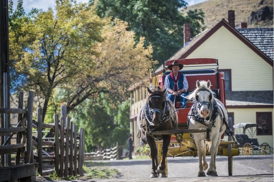
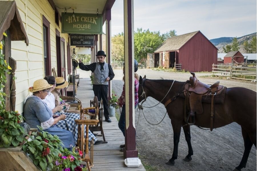
Historic Hat Creek, Cache Creek | Destination BC/Blake Jorgenson
An Indigenous Village puts perspective into the cultural significance of this trip. Since time immemorial, long before ranchers and settlers arrived, people of the Shuswap Nation lived here. If you have time, Indigenous knowledge keepers and cultural guides share stories of the history of their people and their relationship with the land.
The unceded territory of the Nlaka’pamux people stretches from the Fraser Canyon and Princeton in the south to Cache Creek and Kamloops in the north. Occupying much of the Thompson Plateau, the local landscape is home to The Cache Creek Melange – an amazing geological site formed along a subduction zone where a deep oceanic trench developed when the oceanic crust moved under the continental crust. As the earth shifted and roiled, large segments of sediment slid into underwater landslides creating a masterpiece of mudstones, limestones, cherts, and silts.
70 Mile House
1-night stay (detour)
After leaving Cache Creek we recommend choosing between two different options for your first night's stay. A 45-minute detour on Route 97 will take you to Siwash Lake Wilderness Resort in 70 Mile House -an Indigenous-owned business and National Geographic Lodge of the World. Renowned for its eco-adventures and vast wilderness, you can sleep in a luxury glamping site under the stars. Surrender to the healing power of Mother Nature while dreaming about the authentic Indigenous experiences you’ll enjoy in the morning. Fly-fish and feast on your catch or forage for wild plants and learn how to use them for food and medicine. Explore the raw wilderness on horseback or paddle Siwash Lake on canoe or kayak.

Coyote at Flying U Ranch, 70 Mile House | Destination BC/Michael Bednar
Marble Canyon Provincial Park
2-night stay or 1 night if arriving from Siwash Resort
You can travel straight from Cache Creek to Marble Canyon and bypass Siwash Lodge, this option will provide additional time to explore the area. The Park was established in 1956 to protect Marble Canyon, a significant limestone formation at the south end of the Marble Range.
Today, the Park includes Pavilion Lake – a natural freshwater anomaly. The lake is home to microbialites, a type of stromatolite that creates freshwater corral reefs, making its majestic blue waters a scuba diving destination and important scientific exploration site.
In addition to being an area of high scientific importance, it is also culturally rich in Indigenous artifacts, including pictographs. You will encounter these ancient sacred drawings at several locations on this road trip, please leave them exactly as you find them.
There is an easy walking trail that travels through the limestone and dolomite-streaked canyon, which is best viewed at sunrise when the layers of rock are most evident. The twenty-minute trek will take you back over 500 million years in time as you see what lies beneath the lands you explore.
Marble Canyon Provincial Park offers a wide variety of water sport including fishing, swimming, scuba diving, canoeing, and kayaking. A waterfall into Crown Lake is famous among ice-climbers as "Icy BC" and the walls of Marble Canyon are a major draw to rock climbers.
Marble Canyon, “sxmeltám in Secwepemctsin” is located in a rare geological formation, its full height towering over 800 metres into the blue skies above. Locally known as the Cinderella of BC rock, or Chimney Rock “K'lpalekw, also in Secwepemctsin”, means "Coyote's Penis". A climbers’ paradise, it consists of a headwall (500 metres) that sits on top of a large apron (250 metres) which is split by a well-treed terrace, providing some shade for resting climbers.
Water enthusiasts exploring the area may want to stay at Sky Blue Water Resort near Pavilion Lake, which is operated by the local Ts’kw’aylaxw First Nation. At 820 meters above sea level, the lake is high, and the aquamarine waters are crisp.
NASA has a dive team set up on the lake exploring the unique life-forms that dwell within. If you choose to go diving, make sure to consult with an experienced and accredited dive group familiar with the site before planning your excursion. The maximum depth of the lake is 65 meters and the visibility is comparable to saltwater conditions – but extra planning and adjustments are needed to stay safe.
You can camp at Marble Canyon Campground between May and September. There are only 30 sites – first come, first serve. Set between Turquoise and Crown Lakes, there are plenty of hiking trails and places to get out on the water. The campsites are not serviced, but staff come by about once a day. If you want to enjoy a campfire, wood can be purchased.
Fun Facts:
“Coyote, snk̓lip or sek'lep in nsyilxcen and secwepemcstin, is considered a trickster to both Syilx Okanagan and Secwepemc peoples. Coyote is often breaking the rules and bringing teachings through his adventurous mishaps. These teachings have strong ties to local societal values, traditional knowledge, spirituality, and overall worldviews.”
Quote Source: Okanagan College

Gold Country | Photo: Yolanda de Rooy
Lytton - please note that we have retained the content honouring the community of Lytton here as the townsite rebuilds from the devastating fire of 2021. Many of the natural attributes of this destination remain intact. We encourage you to support businesses if you can.
1-night stay
The Village of Lytton is where the turquoise-green waters of the Thompson River meet the brown, silt-laden flow of the Mighty Fraser. One of the oldest, continuously settled communities in North America, Lytton is an important historical stop for travellers.
Originally a First Nations settlement, Camchin ( ƛ'q'əmcín) (the translation in the Nlaka'pamux language means meeting place) bears evidence of Interior Salish people living and gathering on the banks of the confluence for over 10,000 years.
Given its European name in 1858 in honour of British Colonial Secretary, Sir Edward Bulwer-Lytton, a novelist credited with coining the phrase “the pen is mightier than the sword” and author of the novel “The Caxtons”, which cites the ‘the triumph of civilization’ and ultimate displacement of aboriginal inhabitants by Anglo-Saxon settlers as inevitable.
The confluence of the two rivers has been a sacred gathering place and sustainable source of sustenance for the Interior Salish for centuries. The Thompson River is renowned for producing the largest and strongest steelhead in North America, while the Fraser (the longest river in British Columbia) is famous for the fishing of prehistoric white sturgeon. Along with salmon, these fish were important commodities for trading and survival.
Lytton also lies in the cradle of a natural wildlife corridor; home to over fifty species of animals and a bird-watcher’s paradise.
Known as Canada’s Rafting Capital, the river canyons are world famous for white water rafting, kayaking, and sport-fishing. Guides take adventurous visitors through challenging routes on both the Fraser and Thompson Rivers.

Photos: Kumsheen

We recommend a half-day rafting trip on the white-water stretch of the Thompson River. Starting at Frog Rock by Nicomen Falls, the tour takes adventurers over 18 rapids, including Devil’s Gorge, before landing them back on dry ground, in Lytton.
There are great hiking trails leading up Skihist Mountain, which soars 2,968 meters into the skyline and is the highest peak in southwestern BC. Crowning the Cantilever Range, where the Thompson and Fraser Rivers join, you can enjoy day hikes on the lower trails of this majestic peak. A trip to the summit and back is a strenuous, multiday excursion for experienced hikers - but well worth the time!
After your adventures, stop in the Village to check out the carefully curated collection of traditional and contemporary Native Art at the Siska Art Gallery and Band Museum. The Gallery showcases soapstone carvings crafted by local artists using stone collected from the area. In the village, you will find a memorial to Chief Spintlum, who negotiated peace between the Interior Salish and miners' regiments from Yale. Six treaties, known as the Snyder Treaties, were signed; all are lost to modern history.
No visit is complete without a stop at the Lytton Joss House Site, built in 1881 by Chinese workers who came to work on the Canadian Pacific Railway. The Museum is a reconstruction of the original Chinese Temple and provides historical reference and spiritual insight into the significance this temple held for Chinese pioneers.
Ten minutes outside of the Village are the Cisco Bridges, a popular landmark where the Canadian Pacific Railway and Canadian National Railway follow the route of the Fraser River, one on each side, before changing sides at the Bridge. It is a photographers dream location where both bridges are easily framed in the same shot, if you’re fortunate you will capture two trains crossing at the same time.
It’s an action-packed day but there’s a solid selection of accommodation in Lytton. KUMSHEEN Rafting Resort offers a variety of sleeping options, including Anishinabe-style teepees, canvas cabins, RV, and tent sites.
In the Winter:
It’s hard to describe how beautiful the Emerald green waters look when they’re outlined by fresh mounds of champagne snow. Snowshoeing through the mountain trails, ice climbing, or ice fishing are recommended winter activities.
Note: Travelling BC Highways in the winter requires the use of appropriate tires, and a four-wheel drive is strongly recommended. Pack a safety kit including warm blankets, snacks and water. Some travellers choose to carry chains through these areas.
Places to Stay:
Marble Creek Campground - Marble Canyon (40 km northwest of Cache Creek)
KUMSHEEN Rafting Resort - Lytton
Siwash Lake Wilderness Resort - 70 Mile House (recommended by National Geographic)
Check out other accommodations in Cache Creek and Lytton

Flying U Ranch, 70 Mile House | Destination BC/Michael Bednar

Bridge River, Lillooet | Destination BC/Michael Bednar
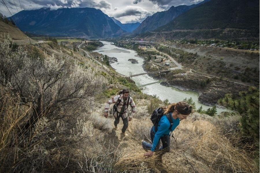
Lillooet
2-night stay
One of the most important locations along the Gold Rush Trail, Lillooet was once the largest settlement west of Chicago and north of San Francisco. Rich in Indigenous history and culture, it remains one of the main population centres of the Stʼatʼimc (Lillooet Nation).
Surrounded by the rugged Lillooet Mountain Range, snow-topped peaks tower well above the clouds. The highest point is Skihist Mountain in Stein Valley Nlaka'pamux Heritage Park. Officially protected in 1995, the name “Stein” comes from the Nlaka’pamux word “Stagyn”, which means “hidden place”. The Valley is made up of diverse ecological zones that include semi-arid pine forests, vast and ancient cedar groves, sub-alpine meadows, and desert-like valleys.
The largest unlogged watershed in the southern Coast Mountains, the Park has over 150 km of hiking trails, four river cable crossings, a suspension bridge, and some amazing campgrounds.

Lillooet, Fraser River | Destination BC/Michael Bednar
The protected designation ensures historic artifacts found in the Park (which includes one of the largest pictograph sites in Canada) are not forgotten or decimated. When travelling the ancestral trails, you enter into a sacred creed of protection with the Indigenous people of these lands, a promise to tread lightly and leave their spiritual places and historical landmarks untouched.
“Asking Rock” is a sacred place in the Park where it’s custom for the Nlaka’pamux to pause and pray for permission to travel the valley. Enter the Park by taking the Lytton Reaction Ferry across the Fraser River – a short 5–10-minute crossing. After off-loading, turn left onto Stein Road and head about 5 km to Trail Road and follow signs to the trailhead. The hike is a short, scenic stroll through the forest to Stryen Creek where you will cross a rustic footbridge. Continue up the trail to a large rock big enough to hold one person. This is the “Asking Rock.” If you look closely, you will see faded ochre paintings believed to possess spiritual powers.
This rock was also used by Indigenous women who would line the stone ledges with soft fir boughs and moss from the forest, creating a natural bed on which they gave birth. Immediately after their arrival, babies were dipped into the cold healing waters of Stryen Creek. Legend says, if you listen closely, you can still hear the sounds of pain and joy echoing in the current.
After your hike, take the ferry back across the Fraser and continue travelling on Highway 12 to Lillooet.
Hiking the Banks of the Fraser River, Lillooet | Destination BC/Blake Jorgenson
If you are an experienced hiker open to extending your visit Stein Heritage Trail is located here. It takes experienced backpackers over a week to travel the 60 km of wild terrain to complete the hike which crosses the Park leading hikers to Stein Lake. Research this hike well; it’s extremely challenging. There is plenty of wildlife such as cougars and bears, so carry bear spray, and survival gear.
Lillooet is surrounded by rainforest-covered mountains but is an arid, desert-like town that lies in a significant rain shadow. Holding the title for the hottest recorded temperatures in Canada, it has a long-growing season perfect for orchards and wineries.
The climate is similar to the grape-growing regions in the Okanagan Valley with hot, dry summers. Viticulture is a new addition to the area's farming scene, with Vitis vinifera grapes first planted in 2004.

Fort Berens Estate Winery, Lillooet | Destination BC/Michael Bednar
There are two wineries in the area - Fort Berens Winery and Cliff and Gorge Vineyards. Be sure to check out both. Fort Berens is an award-winning winery committed to using low-intervention techniques. Cliff and Gorge Vineyards are ‘farmers first’, working with the terroir to produce ‘honest’ wine. These are also great picnic stops close to town!
The Lillooet Museum is home to amazing pieces of First Nations and Gold Rush artifacts. We suggest a quick stop at the museum to hear cultural stories shared by the local volunteers. Admission is free but make a small donation if you can.
With so much history to explore, you will need to choose how to spend your time. There are some significant landmarks to check out including the Mile ‘0’ Cairn, which marks “Mile Zero” of the old Cariboo Road.
In 1942, after the bombing of Pearl Harbor, Canada declared war on Japan, and 309 Japanese Canadians were stripped of their Vancouver properties and relocated to the East Lillooet Japanese Internment Camp. After the war ended in 1945, the Camp was dismantled. In 2017, a Memorial Garden was created to commemorate the 75th anniversary of the Internment as a historic dedication to the families of the camp. The Garden is located on the corner of Highway 12 and Sumner Road.
Take a walk across the historic Old Suspension Bridge built in 1913. This bridge replaced a winch ferry that had been in use since 1860.

Locomotive Mountain | Photo: Natasha Pellatt
The Miyazaki Heritage House is full of history. In 1944, an Internee, Dr. Miyazaki met Artie Phair, owner of Longford House. At the time of their meeting, the town had no doctor, so Artie petitioned the population to allow Dr. Miyazaki (a trained mortician) and his family to set-up practice on the main floor of his home. Their practice covered over 4000 square miles of some of the most rugged country on the planet. Dr. Miyazaki’s efforts to reach remote reserves to attend First Nations’ patients were nothing less than heroic, earning him the Order of Canada. In 1983 he donated the house to the Village of Lillooet. Tours are free.
The Chinese are an important part of Lillooet’s history and the Rock Piles are a reminder of the search for gold by Chinese people before the turn of the century. Washing and sifting through sand and gravel in search of gold, they piled the ordinary rocks, up to 12 feet high, in long rows to prevent having to sort through them again. You can view an intact example of the rocks by Hangmen's Tree.
British Columbia is the number one source of jade in the world. This semi-precious stone has always played an important role in the lives of the area’s Indigenous people. Jade is found in geographic locations where two rock formations shift, forcing the stones to surface from deep under the earth’s crust. Lillooet is one of the unique places that you can still find jade today. The Indigenous people used jade to craft tools and weapons as well as for trade with Coastal Salish and Interior Salish Bands and later, Europeans.
For Chinese gold miners, jade held a special honour as the rock is believed to bring health, wealth, and happiness into their lives. Visitors can check out the Jade Trail in downtown Lillooet!

Photo: Spiltrock Environmental
Located in the Splitrock community of Sekw’el’was, a five-minute drive west of Lillooet on Highway 99, is Splitrock Environmental. Take a guided tour of the property to gain a better understanding of the connection between St’at’imc culture and the land. Also, five minutes from Lillooet, is Xwisten Experience Tours, owned by the Bridge River Indian Band. It offers authentic Indigenous tours of the Bridge River Fishing grounds. Visitors can observe demonstrations of the techniques used to prepare and preserve salmon before enjoying a salmon BBQ and bannock at the Bearfoot Grill. There is a replica of a pit house (s7ístken) winter home of the St'át'imc people on the site that features an archaeological village containing impressions of over eighty pit houses.
There are several hikes in the area including Seton Lake Trail. This is a short (but steep) hike from the Seton Trail Lookout with amazing views of Seton Lake and Duffey Lake Road U-turn.
Fun Facts:
Fun facts: Lillooet is one of the only areas in Canada where apricots grow wild from seeds.
In the Winter:
Tsek Hot Springs and the sacred location of the In-SHUCK-ch and St’át’imc people (nkúkwtsa)
Fish with Great River Fishing Adventures on the Lillooet River
Snowshoe at Seton Lake Trails
Note: Travelling B.C. Highways in the winter requires the use of appropriate tires, and a four-wheel drive is strongly recommended - especially for this route. Pack a safety kit including warm blankets, snacks and water. Some travellers choose to carry chains through these areas.
Places to Stay:
Lillooet Sturgeon Lodge B&B - Lillooet
Retasket Lodge and RV Park - Lillooet
Texas Creek Campground - Lillooet
Reynolds Hotel - Lillooet

Mountain Biking Near Pemberton | Destination BC/Reuben Krabbe
Pemberton/Whistler
2-night stay
The drive between Lillooet and Pemberton on Highway 99 (Duffey Lake Road) is one of the most spectacular road trips on the planet, and we think you’ll love it as much as we do! The vast forests, glacial lakes, and dramatic mountain ranges are breathtaking, but there is only one good opportunity to pull over. Duffey Lake Road Viewpoint, halfway between Lillooet and Pemberton (49.5 km in either direction) is a must-see!
A little further south (about 70 km from Lillooet) is Joffre Lakes Trail – an 11 km hike that takes at least four hours round-trip. If you’re up for the challenge, you won’t regret it! You’ll see stunning views of Matier Glacier, three turquoise blue alpine lakes, surrounded by a pristine mountain range.
Tip: From Lower Joffre Lake, a short walk from the parking lot, you can catch glimpses of the glacier in the distance.
The vivid blue colour of the three lakes comes from glacial silt which floats in the water, reflecting green and blue wavelengths created in the sunlight. The views are amazing from any vantage point on this trail, but they get better as you go!
The trailhead is accessed off Duffey Lake Road. Starting at the lower lake, follow the path to your left, over a wooden bridge (along the shoreline) to a forested area that leads to a boulder field. From this point, your climb is steep, with the rushing waters of Joffre Creek audible in the stillness.
As you get higher, you will catch glimpses of Middle Joffre Lake peeking through the trees. Push a little further to reach the lake. The view from here is incredible with the intense blues of the water contrasted by a deep green treeline and the glacial clad mountain. Continue for 15-20 minutes until you will reach another small wooden bridge and a large floating log. You can walk out to snap a pic but be careful as the water is very cold!
Even though you can catch glimpses of Upper Joffre Lake you still not to the half-way point, there is a long way around the lake to the top where it gets rockier at the foot of the glacier. This is the perfect spot for a picnic but be sure to pack out what you pack in because this area belongs to the wildlife.

Mt. Rohr | Photo: Natasha Pellatt
Pemberton Valley Lodge, just over 1.5 hours from Lillooet, is a popular place to stay for the last couple of nights of your road trip. This splurge stop is close to everything and the mountain-side kitchen suites come with a cozy fireplace. Or check out Ivey Lake Lodge, for a more intimate experience in one of three quaint cottages, just outside of town.
Nairn Falls Campground just 20 minutes north of Whistler, is a perfect place to set-up base camp, and close to the falls. The park has facilities for tents and RVs, day-use picnic areas, a hiking trail to a waterfall, and an extensive network of hiking and mountain biking trails. There are 94 sites available with full-service sites operating between May 10 and the end of September. Reserve your spot through Discover Camping, or first-come, first-serve.
Nairn Falls Provincial Park is a spiritual site for the Lil’wat Nation. Set on the Green River, widely known for its moto-cross trails, the protected forest is a mix of western hemlock, red-cedar, and coastal Douglas-fir, revered for their robust fragrance and essential medicinal values.
Nairn Falls Trail is a 3 km round trip, traditionally used to access the falls and Mount Currie trail systems. It takes at least 1.5 hours to do the hike. Stick to the trail and watch your footing along the steep banks and drop-offs.The view of the falls is breathtaking. From the platform, visitors can see the turquoise water as it rushes through deep channels of rock before plummeting sixty meters into the churning foam of the Green River. Take a bit of a detour on your way back and check out the lower falls tumbling into the canyon.
One Mile Lake Trail takes you 2 km north of the campground to One Mile Lake where you can take a dip or paddle in the cold alpine water. There is nothing extraordinary about this trail, but there is something exceptional about doing yoga on a paddleboard in the middle of the most majestic mountains on the planet.

Whistler/BC Ale Trail
Check out Coudre Point where the trail meanders through the marsh-like terrain bordering the banks of the Green River. About 25 km long, the river is a fast-moving tributary of the Lillooet River best known for fishing. There are white-water rafting tours which book from Whistler Village. These waters are much tamer than the rapids in Lytton, ideal for beginners or those wanting to take in the area’s majestic views from the water.
Brandywine Falls is a 45-minute drive from Pemberton, and one of Whistler’s most iconic and photographed waterfalls. It’s an easy 15 minutes and well worth it to see the waterfall careen 70 meters over a sheer cliff before colliding with the canyon floor, creating a backsplash of rainbow.


Whistler Olympic Plaza | Squamish Lil'wat Cultural Centre/Blake Jorgensen
Alexander Falls is at the top of Callaghan Road, just before Whistler Olympic Park. Known as one of the best "unofficial" bear-watching sites in Whistler, expect to see one during your visit. Make sure you have bear bells and spray and remember, this is their home – so respect their space.
The falls are part of the 21 Mile Creek Trail System. The surrounding country is wild, and less travelled. The waterfall is stunning in its natural environment, crashing through a narrow boulder-filled channel into a lively stream known as Madeley Creek.
If you are looking for a world-class fishing experience, you’ve come to the right place. There’s an impressive variety of species including rainbow trout, Dolly Varden char, cutthroat trout, steelhead, whitefish, and five types of salmon. Brad Knowles and his guides at Pemberton Fish Finder will take good care of you.
The Whistler and Pemberton wilderness are abundant in wildlife providing ideal habitat for deer, black bears, cougars, marmots, rabbits, birds, and fish. An impressive number of bird species call the area home. From hummingbirds to bald eagles, stellar jays, ptarmigan, and whiskey jack it is a bird-watchers paradise.
Whistler Mountain | Destination BC/Blake Jorgenson
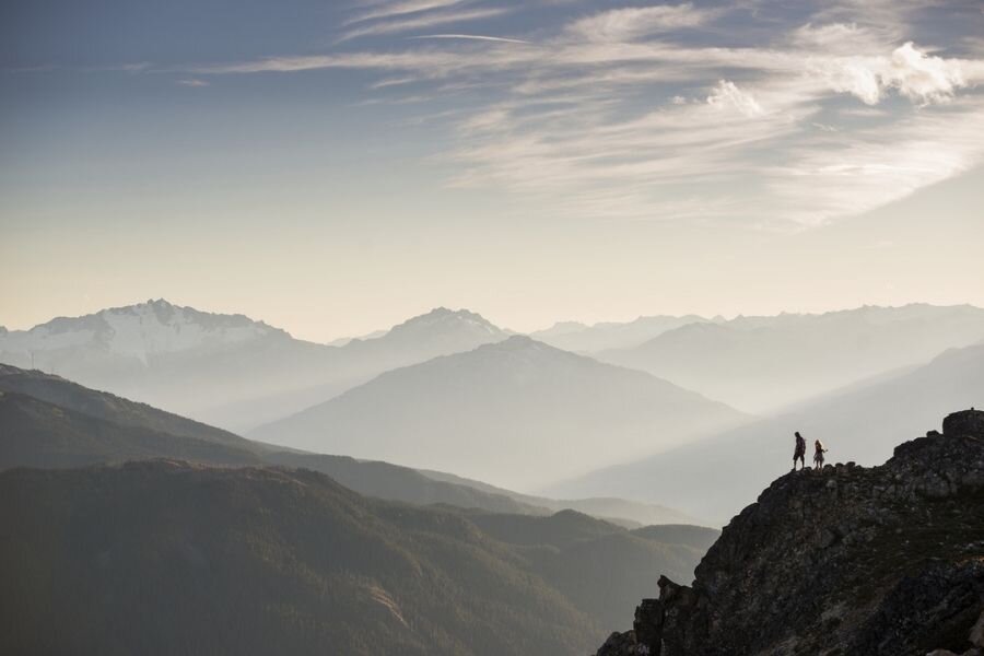
Set in the Coast Mountains, the landscape of Whistler has been carved by the pass between the headwaters of the Green River and the upper-middle reaches of the Cheakamus River. Flanked by glaciated mountains on both sides, ancient metamorphic rocks, between 100-200 million years old, form the ridge of Blackcomb Mountain, with an elevation of 2,436 meters. Whistler Mountain reaches 2,182 meters, and both mountains offer an extensive range of hiking and climbing trails.
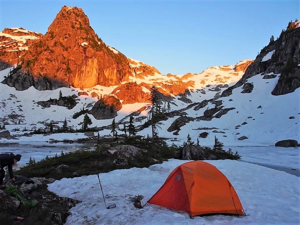
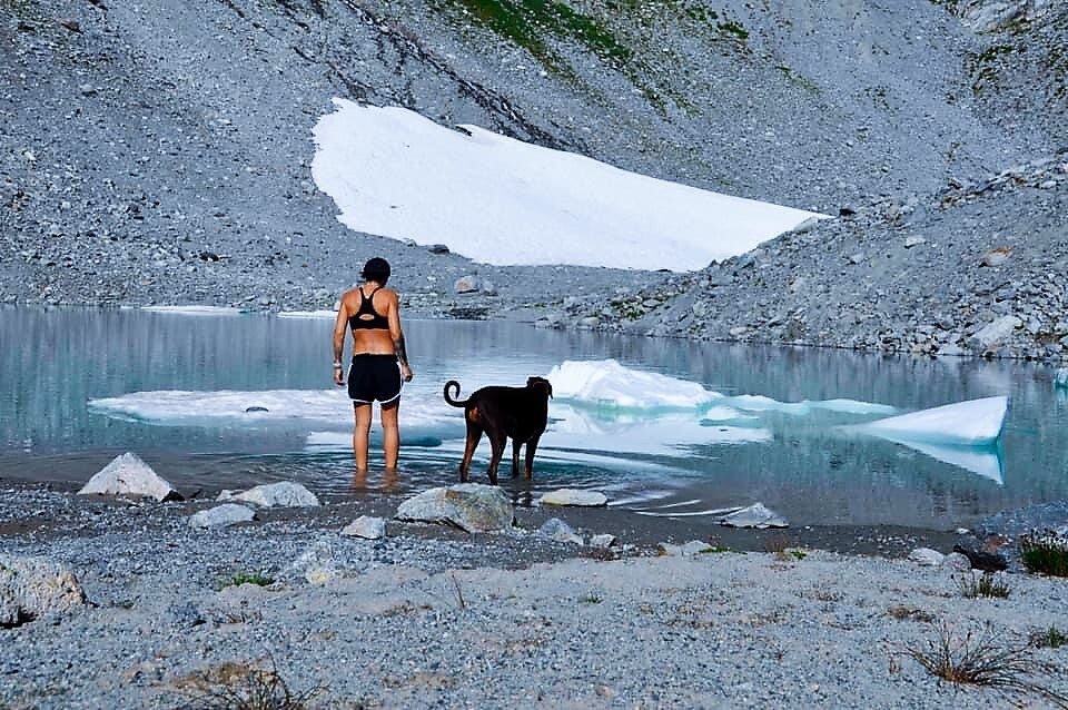
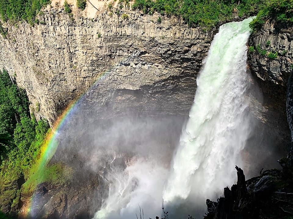
Photo Credit: Natasha Pellatt
At one time, tens of thousands of Coast Salish First Nations people lived and traded between Vancouver, Howe Sound, and the Lillooet area with Whistler serving as a waypoint for trading routes between the Squamish and Lil'wat Nations. It is one of seven communities selected as the recipient of the provincial government's Green City Awards for demonstrating leadership and action in a range of sustainability initiatives. It is also recognized as the first community in Canada to have achieved the fifth and final milestone within the Partners for Climate Protection (PCP) Program.
The Pemberton Heritage Museum takes visitors down memory lane. A collection of buildings, including three original hand-hewn homes containing artifacts dating back to the 1860s, are on display in this street side, open-air format. Formally known as Port Pemberton, the village was once a significant stopping point on the historic Harrison-Lillooet Gold Rush Trail. Cultural reference to the self-sufficiency of the Lillooet [Stl'atl'imx] people before contact with Europeans is conceptually captured with a focus on the changes that occurred after colonialization.
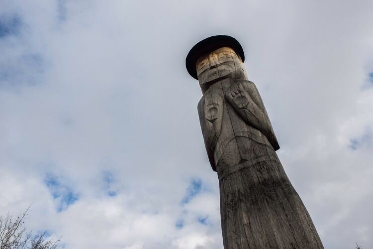
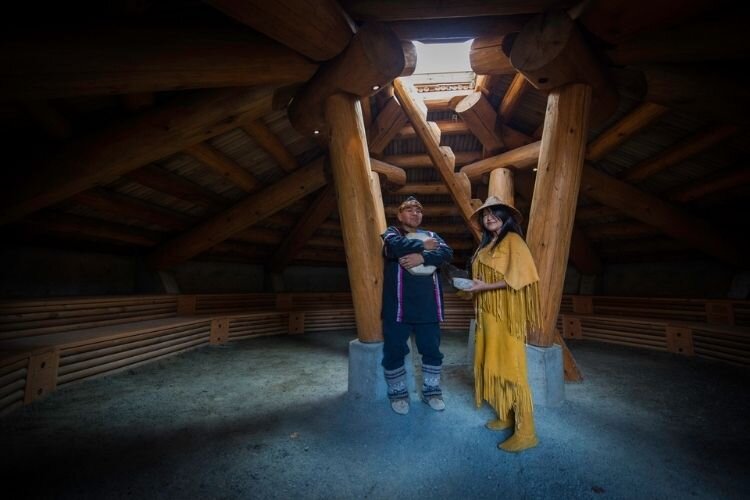
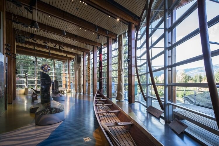
The Vagabond gem on this road trip is the Squamish Lilwat Cultural Centre. No visit to the area is complete without immersing oneself in the authentic history of the region, and the relationship the Indigenous people nurture with this sacred land and its bounty. The Centre shares the heartbeat and heartbreak of the Squamish and Lil'wat Nations through traditional welcome songs, drumming, and storytelling.
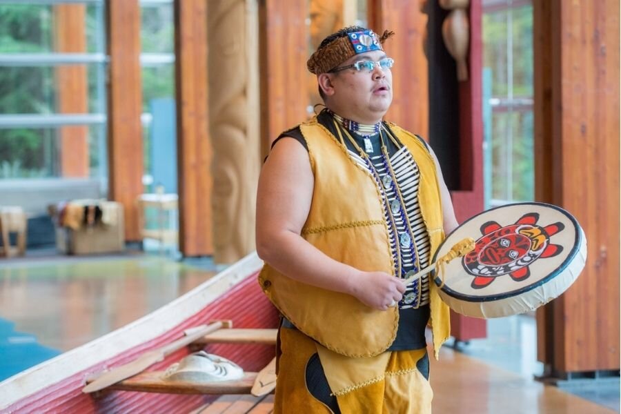


Squamish Lil'wat Cultural Centre/Blake Jorgensen
An intimate and enlightening experience, guests will visit a pit house, where geothermal cooling and heating were ancient knowledge, not future aspirations, and learn of local vegetation and multiple uses. Wander through the interpretive trails, spend time with a knowledge keeper, taste the food and breathe the air – you will leave this place with a deeper appreciation of the people who call these lands home.

Sea to Sky Highway | Destination BC/Blake Jorgenson
Heading straight from Whistler to Cache Creek will take about 3.5 hours on Highway 99; continuing to Vancouver on the Sea to Sky Highway around 1.5 hours. Travel with care to wherever you call home.
Fun Facts:
Fun facts: The name “Whistler” comes from the call of the hoary marmot.
In the Winter:
If you love the snow, you’ll be in paradise with the activities available. Whistler hosted several sports during the 2010 Winter Olympics. Rather than listing individual suggestions, we are patching you through to the official website.
Note: Travelling B.C. Highways in the winter requires the use of appropriate tires, and a four-wheel drive is strongly recommended. Pack a safety kit including warm blankets, snacks and water. Some travellers choose to carry chains through these areas.

Whistler Blackcomb Ski Resort | Destination BC/Randy Lincks
Places to Stay:
Pemberton Valley Lodge - Pemberton
Nairn Falls Campground - Pemberton
Riverside RV Resort and Campground – Whistler
Crystal Lodge Hotel – Whistler
Ivey Lake Lodge - Pemberton
Please check our Responsible Travel Boxes curated with local artisan wares and the planet in mind. Our boxes offer essential road trip items with a twist – they are naturally good for you, the planet, and our economic recovery.